
Iran Map – Area, Location, Bordering countries
Iran – Area, Location
- The area of Iran is 1.648 million Km2.
- Iran spans the continent of West Asia.
- Iran is the sixth-largest country in Asia.
- and by size and population, the seventeenth-largest country in the World.
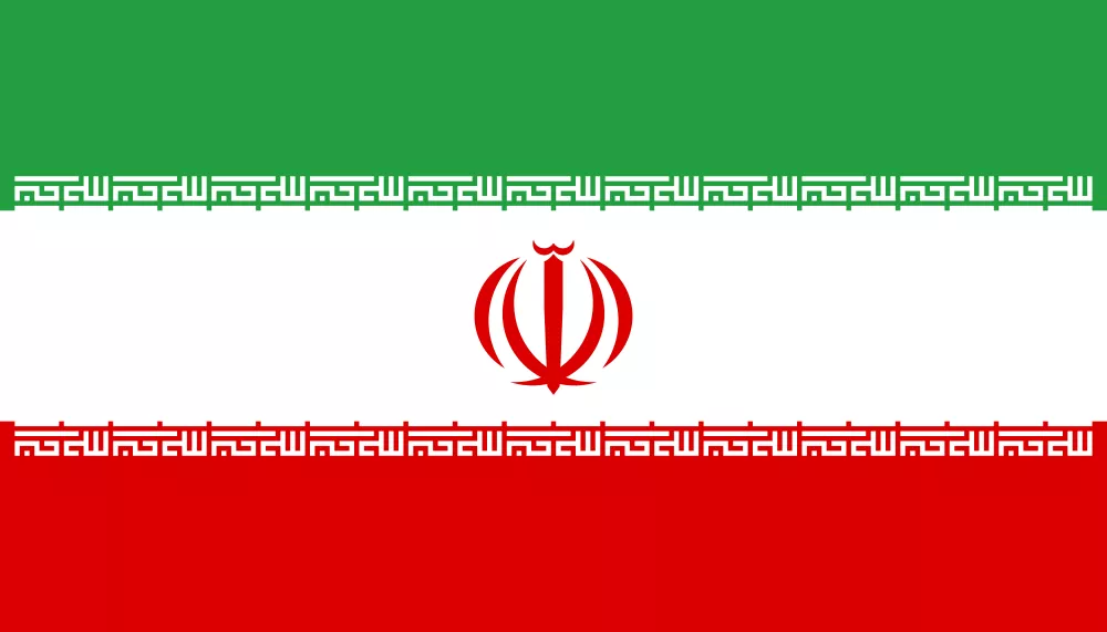
Flag of Iran
The Flag of Iran is a horizontal tricolor flag. with Green, white, and red Strips. And in the central emblem, the same phrase is repeated in a bold inscription of Kufic script along the edges of the green and red bands.
Key Features
Tricolors with 3 equal horizontal bands – Green on top, White in the middle, and red at the bottom
The center of the flag has a red symbol shaped like a tulip and sword, which also represents the word Allah (God)
The phrase “Allahu Akbar” is written 22 times along the edges of the green and red stripes.
Symbolism
Green – stands for Islam, nature, and happiness.
White – shows peace, freedom, and unity.
Red – means bravery, courage, sacrifice, and love.
Emblem – shaped like a tulip and sword, it represents the five main principles of Islam.
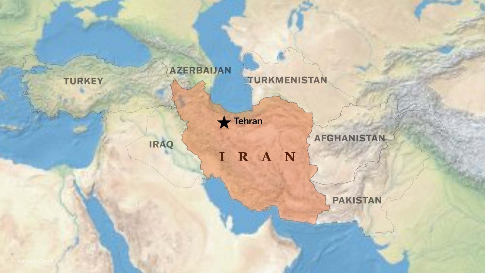
Iran’s Bordering countries with directions
Northern Borders
- Armenia
- Azerbaijan (including the Nakhchivan exclave)
- Turkmenistan
Eastern Borders
- Afghanistan
- Pakistan
Western Borders
- Turkey
- Iraq
Southern Borders (water, not land)
- Persian Gulf and Gulf of Oman coastline
Topography & Landscape Of Iran
Iran’s land is mostly high and rugged, with mountains, plateaus, and deserts shaping the country.
- The Zagros Mountains run across western and southern Iran, creating a natural barrier.
- The Alborz Mountains rise in the north, along the Caspian Sea, where Iran’s highest peak, Mount Damavand(5,610 m), is located.
- Much of central Iran is covered by a high plateau, broken up by desert basins like the Dasht-e Kavir (Great Salt Desert) and Dasht-e Lut, one of the hottest places on Earth.
- In the northwest, the land is more hilly and semi-arid, while the southern region opens to coastal plains along the Persian Gulf and the Gulf of Oman.
- Iran also has fertile lowlands by the Caspian Sea, which are green and humid compared to the dry interior.
Rivers and Water Bodies
Karun River is the longest river in Iran, flowing through the southwest into the Persian Gulf. Sefid Rud is an important river for farming in northern Iran. It flows into the Caspian Sea.
The Caspian Sea is the world’s largest inland body of water, which lies in northern Iran. Lake Urmia was once one of the largest saltwater lakes in the world, but it is now much reduced in size. Hamun Lakes are seasonal lakes in the southeast, fed by rivers from Afghanistan.
Climate & Ecosystems of Iran
Iran has many different types of weather. The Caspian Sea coast is mild and humid, the middle of the country is hot and dry, the northwest has cold winters, and the central and southeastern areas are desert-like with very warm, dry conditions.
Watch Iran Country Profile Video
US attack on Iran, explained Watch on YouTube: Click me
