Why does Mexico have two Californias?
Most people don’t know the real reason why Mexico has two Californias.
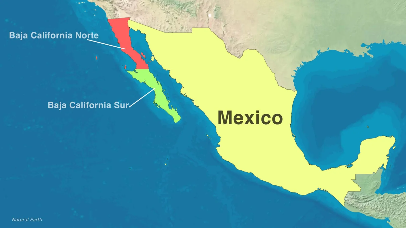
Originally, this entire peninsula was one territory: Baja California, including Baja California Norte and Baja California Sur, right next to Alta California.
But in the mid-1800s, the United States seized Alta California, taking advantage of its sparse population. Mexico feared the same fate for the peninsula, since only La Paz was populated, and just a few ships could capture it, giving control over the whole peninsula.
To prevent that, Mexico split the land in two, creating separate population centres that could be defended individually: Baja California Norte and Baja California Sur, each with its own government and defences.
Over time, the North developed faster, grew wealthier, and became more influential than the South — cementing the division.
That’s why today, Mexico isn’t home to one California… but two.
Read More Florida County Map
watch on YouTube, why Mexico has two Californias?
A Mythical Start (1500s)
Way back in the 1500s, Spanish explorers like Hernán Cortés sailed to a long, skinny strip of land in what’s now Mexico. They thought it was an island and named it California, inspired by a book about a paradise called California, ruled by Queen Calafia. Spoiler: it wasn’t an island—it was a peninsula! But the name stuck.
Splitting the Land (1800s)
For a while, all of California—north and south—was one big region ruled by Spain, then Mexico. The northern part was called Alta California (Upper California), and the southern peninsula was Baja California (Lower California). In 1848, after a war with the U.S., Mexico lost Alta California, which became the U.S. state of California. Mexico kept the peninsula, still called Baja California.
Two States, One Peninsula
-
Baja California (north): This is where you find bustling cities like Tijuana and Ensenada. It became a state in 1953.
-
Baja California Sur (south): Think sunny beaches and chill vibes, like in Cabo San Lucas.
Why It Matters
The “two Californias” in Mexico show how history, a war, and a need for organisation shaped the map. That old storybook name from the 1500s still lives on in both states! Plus, it’s a reminder of how borders and names can change over time. Today, Baja California and Baja California Sur are awesome places with beaches, deserts, and a shared history that started with a myth.