Maps Of Algeria
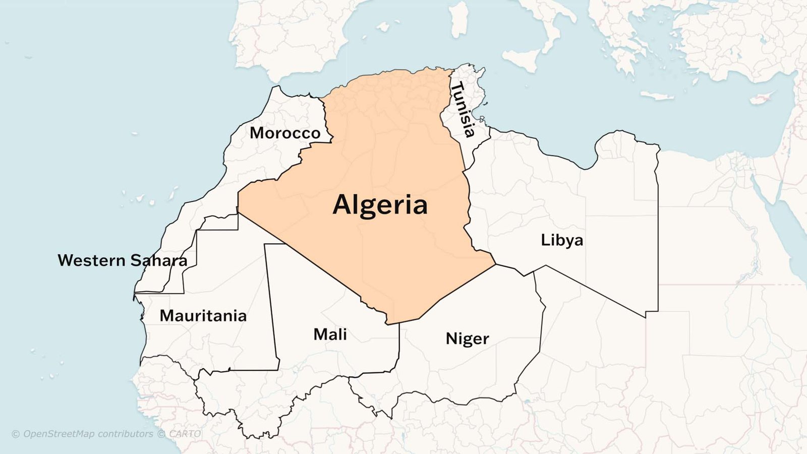
Location in Africa
Algeria is the largest country in Africa. It covers about 2,381,000 square kilometers. It is in the northern part of the continent and has a long coastline along the Mediterranean Sea. The country has a population of around 44 million people. The highest point in Algeria is Mount Tahat, which rises to about 3,003 meters. The deepest point is Chott Melrhir, a dry salt lake that lies about 40 meters below sea level.
Neighbouring Countries
Algeria shares borders with several countries. To the east are Tunisia and Libya. To the south are Niger and Mali. To the southwest are Mauritania and Western Sahara. To the west is Morocco. These borders allow Algeria to trade goods and share cultural ties with different regions of Africa.
Northern Coast
The northern region is the most populated part of Algeria. It has milder weather because the Mediterranean Sea keeps temperatures moderate. This area has farms, towns, and major cities. Farmers grow olives, wheat, fruits, and vegetables here. The land is more fertile. The capital city, Algiers, is located along the northern coast. This region is also important for trade because many ships arrive at its ports.
Mountain Ranges
South of the coast are the Tell Atlas and Saharan Atlas mountains. These long mountain chains stretch from west to east across the country. They separate the cooler, wetter north from the hotter and drier parts of central Algeria. The mountains also affect rainfall. The northern slopes get more rain, while the southern slopes stay dry. The mountains have valleys where people farm and raise animals like sheep and goats.
Sahara Desert
Most of Algeria lies in the Sahara Desert, one of the hottest and driest places in the world. People know the desert for its sand dunes, rocky plains, and very little water. Daytime temperatures can be extremely high, while nights can be surprisingly cold. Life in the desert is difficult, but people still live in certain areas. They stay near oases, where underground water reaches the surface. Date palms, small farms and villages are found around these oases.
Desert Landforms
The Sahara has many different landforms. You’ll find tall sand dunes that rise hundreds of meters. There are also wide, flat rock surfaces and large dry basins. In southern Algeria, the land rises into the Ahaggar Mountains. These mountains are made of ancient volcanic rock and include Mount Tahat. The desert also has unique rock formations shaped by wind over thousands of years.
Weather and Climate
Algeria has three main climate zones. The north has a Mediterranean climate with mild, wet winters and warm summers. The central region sits between the mountains and the desert. It is semi-dry and receives little rain. The southern region, which is the Sahara, has very hot summers, cold nights and almost no rainfall. Sandstorms are also common in the desert.
read more about What are these Hammerhead Peninsulas of Pakistan?
Languages of Algeria
The main languages spoken in Algeria are Arabic and Berber. Arabic is the official language used in schools, offices and government. Berber is also recognized as a national language and is spoken in many rural areas. French is common in business, science, and daily life in Algeria. This is due to the country’s history as a French colony.
Economy and Income
Algeria’s economy depends heavily on oil and natural gas. These resources bring in most of the country’s income. The country also produces minerals, farm products and fish from the Mediterranean Sea. Many people work in services like trade, transportation and government jobs. Algeria is developing new industries to reduce its dependence on oil.
A Country of Rich Culture
Algeria has a mix of Arab, Berber and Mediterranean traditions. Music, food, clothing and festivals show this cultural blend. The country features ancient Roman ruins, old desert towns, and key historical sites that draw visitors.
Watch Geography of Algeria