What are these Hammerhead Peninsulas of Pakistan?
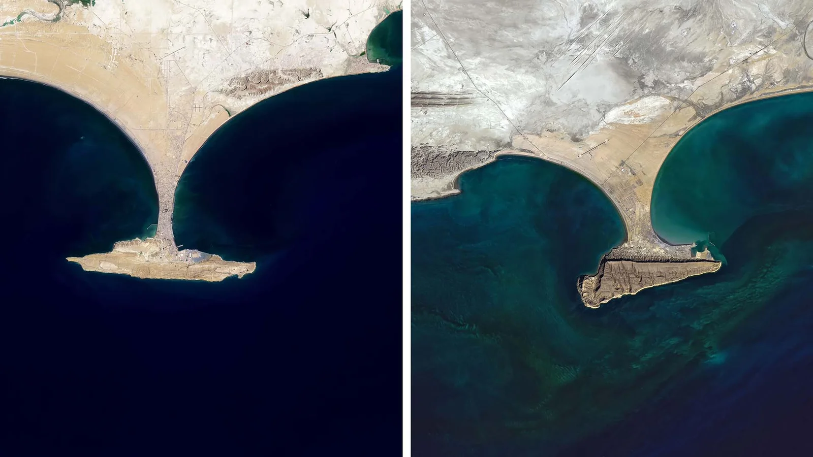
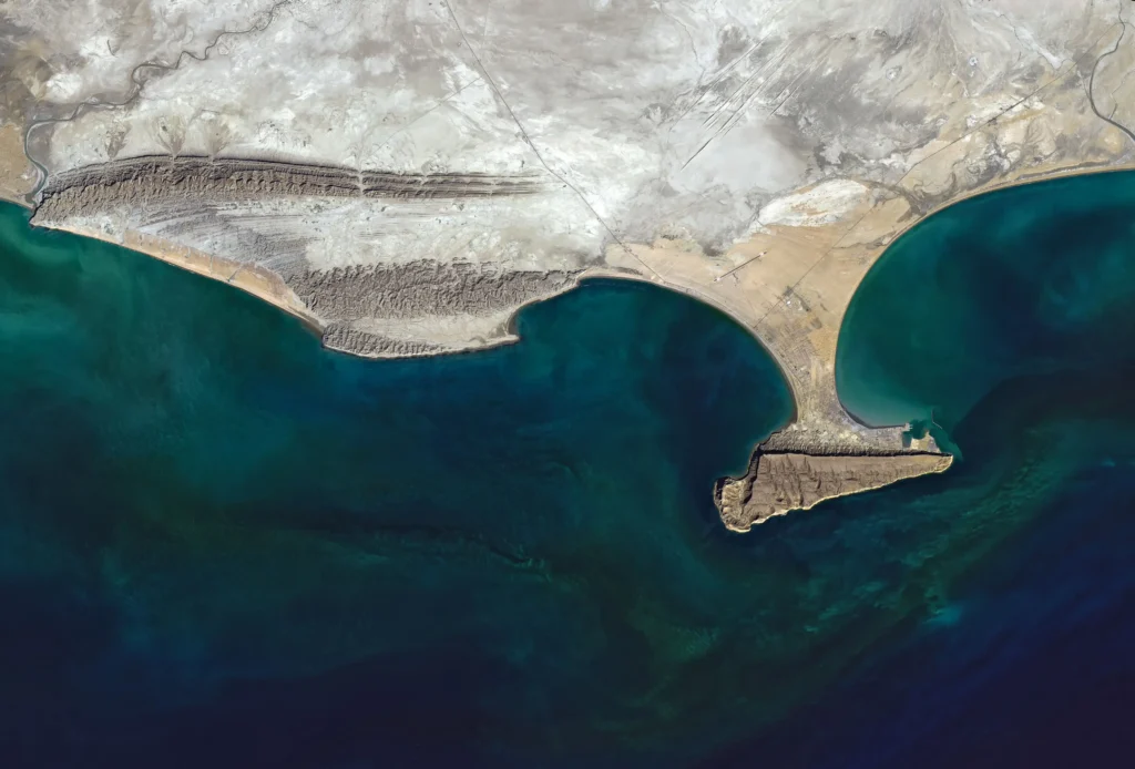
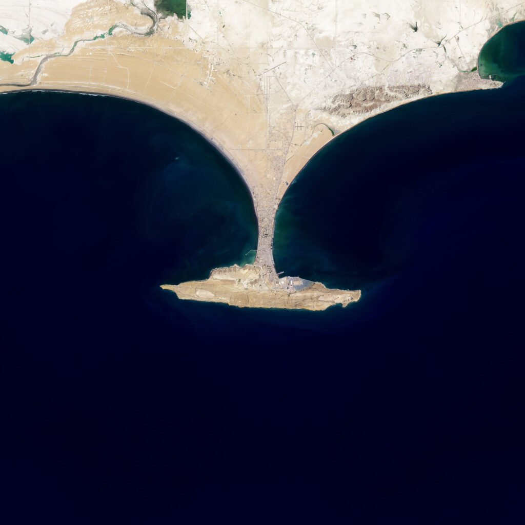
When you zoom into the map of Pakistan along the Makran coastline, you will find two oddly shaped peninsulas. These are hammerhead-shaped peninsulas near the cities of Gwadar and Ormara.
Both of them have the same geological features. Both of them have long, raised, sloped areas called terraces. And these terraces are connected to the mainland by a thin section of sand called Tombolo.
But how these oddly hammerhead-shaped peninsulas formed in the first place. And why are they not found anywhere else? What makes them so unique?
This is the Makran coast of Pakistan (shown in the image). Here, two tectonic plates are colliding. The Arabian plate is colliding with the Eurasian plate. Because of this, we have many fold mountains in Pakistan. But let’s not go there and keep our focus on the coastline.
The Arabian Plate is pushing against the Eurasian Plate. Oceanic plates are denser than continental plates. When an oceanic plate collides with a continental plate, it usually slides underneath the continental plate. This process is called subduction.
In this case, subduction is happening, but some pieces of the ocean plate have broken off. These pieces stick to the land plate. Scientists call these stuck-together pieces “accretionary wedges.”
These scraped-off parts are made of marine sediments like sand and mud. Which, with time, turn into rocks such as sandstone and limestone. That’s what most of these peninsulas are made of.
As the Arabian Plate moves under the Eurasian Plate, it also creates fault lines — cracks in the Earth’s surface. Along these lines, older rocks are pushed on top of newer ones. That’s how the land in this area got pushed up and formed raised terraces near the coast.
This kind of raised land is called a horst, while the lower land around it is called a graben. Both of the peninsulas, one in Ormara and the other in Gwadar, are horst blocks. The horst was lifted up from the ocean floor, while the land around it sank lower.
But now the question arises: if this is the same fault line, why don’t all these fault blocks look the same? Or continue evenly along the coast?
A simple explanation is that this is because the Earth’s crust didn’t break evenly. Some parts had more sediment or different fault lines. This made the coastline uneven, forming the separate peninsulas we see today.
But there is still the missing piece in the puzzle. If this is part of the Horst block, then why is it connected to the mainland?
So, the Gwadar and Ormara horsts both used to be islands. Over time, the action of waves and drifting sand created long sandy spits. These long sandy spits, called tombolos, are depositional landforms that connect the islands to the mainland.
So, how did these hammer-shaped peninsulas form? The Arabian plate is subducting under the Eurasian plate. In this process, part of the Arabian plate stuck to the Eurasian plate. Accretionary Wedge. This scraped part gradually turned into sandstone and limestone. There is a fault line with horsts and grabens. Both peninsulas, one in Ormara and the other in Gwadar, are horst blocks. They were once islands, but over time, sand deposits formed tombolos that connected these islands to the mainland. Today, we have unique hammer-shaped peninsulas.
Hammerhead Peninsulas of Pakistan
When you look closely at a map of Pakistan’s Makran coastline, you’ll see two unusual peninsulas near the cities of Gwadar and Ormara. These peninsulas look like hammerheads and have long, raised, sloped areas called terraces. Each terrace is connected to the mainland by a thin strip of sand called a tombolo. These shapes formed because two huge pieces of Earth’s crust, called tectonic plates, are pushing together. One plate slides under the other, lifting up ocean floor sediments like sandstones and limestones to create the terraces. Waves then carry sand and drop it, forming the tombolo that links the terraces to the land.
Watch this video
Read more: Physical geography of the USA for students