This tour will take you back in time on the old Lincoln Highway—America’s first coast-to-coast road, established in 1913. Today, much of the original road has been paved over or covered in gravel, but the open land of the Laramie Basin looks almost the same as it did long ago.
Crossing this huge prairie has always offered travellers unique challenges and surprises, from ancient times to today. The only thing that has changed is how we travel.
Driving in the Wild West
When the Lincoln Highway opened in 1913, there was no official system to fix roads. Each county had to take care of its own section using volunteers. Drivers were mostly on their own. The road could quickly disappear under heavy snow, thick mud, or spring floods.
Back then, there was no Wyoming Highway Patrol, no speed limits, and you didn’t even need a driver’s license (that rule didn’t start until 1947). Despite these challenges—or maybe because of the adventure—the romance of the historic Lincoln Highway lives on.
How the Highway Was Built
In 1912, Carl Fisher, who helped build the Indianapolis Motor Speedway, came up with the idea for a graded road that stretched from coast to coast. A year later, the Lincoln Highway Association was formed. Their goal was to create a continuous, improved highway from the Atlantic Ocean to the Pacific Ocean that anyone could use for free.
Henry B. Joy, the president of the Packard Motor Car Company, was elected as the leader of the Association. Other car companies supported the plan and raised $2 million in the first year. However, Henry Ford surprisingly refused to help. He believed that building good roads should be the government’s job, not a project for private businesses.
The Lincoln Highway Association created a red, white, and blue logo in 1913. When drivers saw this painted on telephone poles and fence posts, they knew they were still on the right path.
When the Lincoln Highway era ended in 1928, the Association wanted to make sure the road’s dedication to Abraham Lincoln was not forgotten. One of their final acts was to have Boy Scouts install standard concrete markers along the route. Some of these markers still stand in Wyoming today, though most are missing the small bronze Lincoln medal that was originally set into the concrete.
Read More: Jean Beliveau World Record Walk
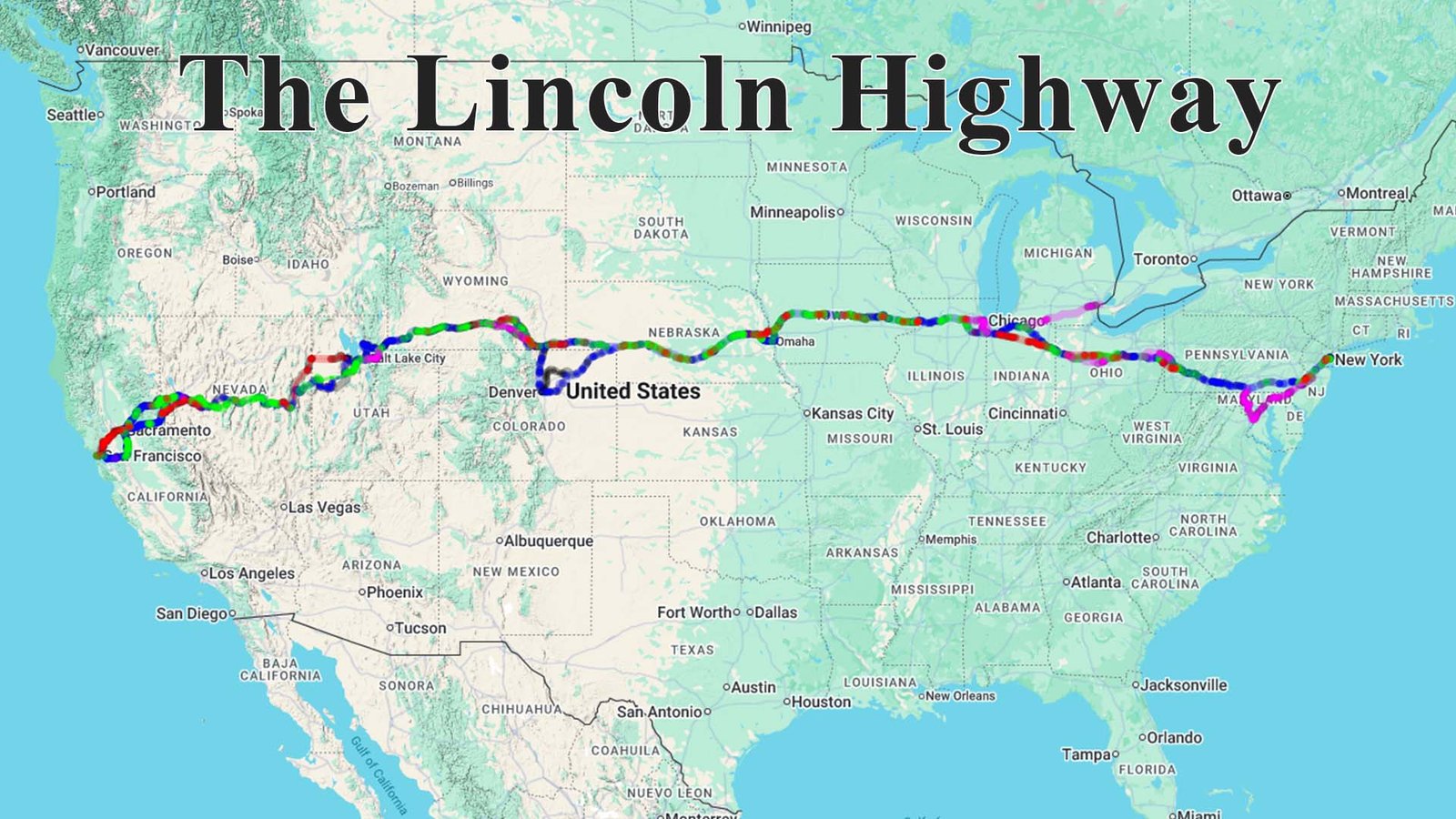
The Lincoln Highway Road Map (Important Cities)
The Lincoln Highway originally passed through 13 states when it was dedicated in 1913. Because the route evolved over time (for example, the “Colorado Loop” was removed in 1915), some cities were bypassed in later years.
Here are the important cities along the classic route, moving East to West:
1. New York
-
New York City (Times Square – The official eastern terminus)
2. New Jersey
-
Jersey City
-
Newark
-
Trenton (Historical crossing of the Delaware River)
3. Pennsylvania
-
Philadelphia
-
Lancaster
-
Gettysburg
-
Pittsburgh
4. West Virginia
-
Chester (The highway clipped the very northern tip of the state, though the original 1913 route bypassed it; it became part of the official route in 1927).
5. Ohio
-
Canton
-
Mansfield
-
Lima
6. Indiana
-
Fort Wayne
-
South Bend
-
Valparaiso
7. Illinois
-
Chicago Heights & Joliet (The route intentionally bypassed the congestion of downtown Chicago).
-
Aurora
-
Dixon (Site of the “Victory Arch”).
8. Iowa
-
Clinton
-
Cedar Rapids
-
Ames
-
Council Bluffs
9. Nebraska
-
Omaha
-
Kearney
-
North Platte
10. Colorado (Part of the original 1913 “Loop” – later removed)
-
Denver (The original route dipped south from Nebraska to hit Denver before going north to Wyoming. This was dropped in 1915 for a more direct path).
11. Wyoming
-
Cheyenne
-
Laramie
-
Rock Springs
12. Utah
-
Salt Lake City
-
Tooele
13. Nevada
-
Ely
-
Reno
-
Carson City
14. California
-
Sacramento
-
Oakland
-
San Francisco
Watch Now
How the most dangerous place on the planet breaks the Pan American Highway here