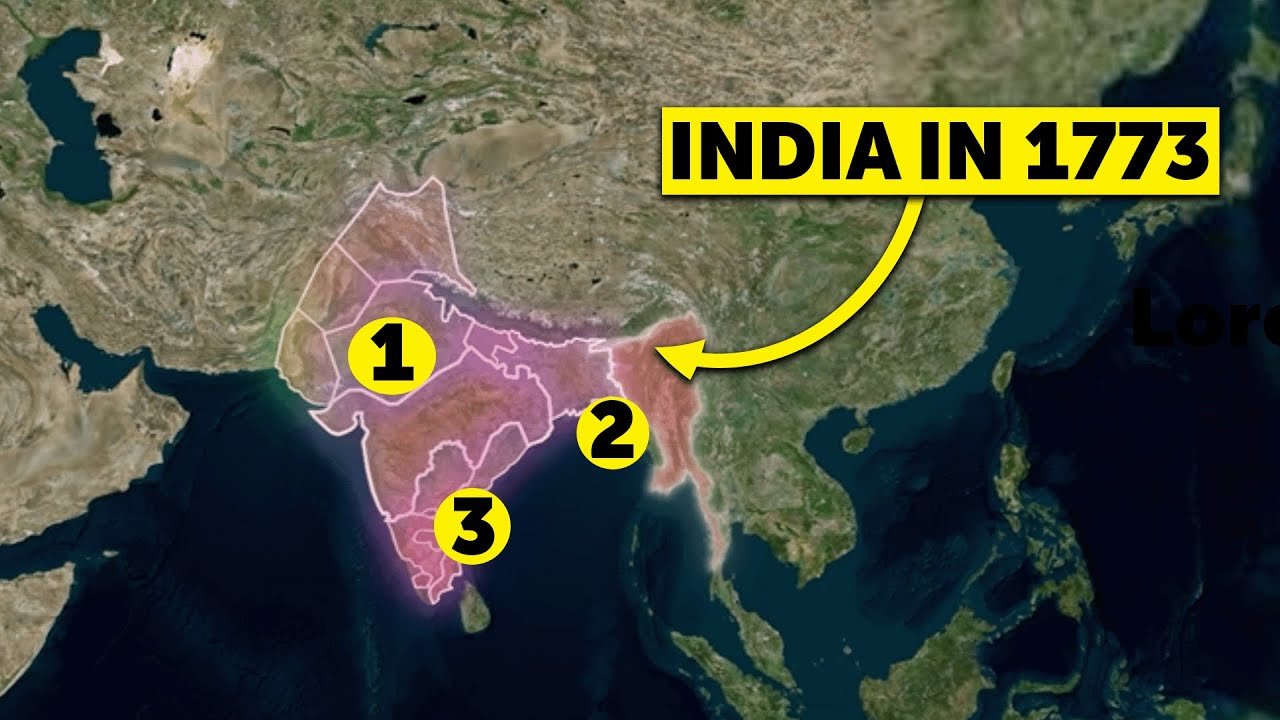
In today’s post, we’re diving into a detailed analysis of India’s political map during the 1773 –1783 period i.e. map of India 1773 – 1783. You might wonder why this specific timeframe? While not particularly unique, this period aligns with key events we’ve covered in previous posts—Land Revenue Systems, the Subsidiary Alliance, the Battle of Plassey, and the Battle of Buxar. Exploring this era will give you a clear perspective of India’s historical landscape. If you haven’t checked out those posts, don’t worry! Finish this one first, then dive into:
- Battle of Plassey
- Battle of Buxar
- Land Revenue System
These will make future topics easier to grasp. Let’s jump into the map of India during 1773–1783, starting with the territories under the English East India Company.
Watch video: Click me
The English East India Company’s Territories
The English East India Company, though present in India since 1601–02, truly established its dominance after 1757. Following the Battle of Plassey (1757) and the Battle of Buxar (1765), the Company gained control over Bengal, Bihar, and Orissa. By 1772, Warren Hastings sidelined the Nawab, bringing these regions fully under British control. The Company also held Benaras and its surrounding areas, parts of the eastern coast (Northern Circars and portions of Madras), and the western coast (Bombay, Thane, and nearby regions).
The Decline of the Mughal Empire
The 1773–1783 period marked one of the Mughal Empire’s darkest phases. Once spanning from Afghanistan to Bengal and Kashmir to Hyderabad, the empire was reduced to Delhi and a few square kilometres around it due to weak rulers and divisive policies. By this time, Delhi itself had become a protectorate state under the Maratha Sindhia family. A protectorate state relies on another power for defence, ceding sovereignty over foreign affairs and military decisions. In 1857, the Mughals at least fought back, but during this period, their influence was negligible.
The Maratha Confederacy: A Formidable Force
The Maratha Empire was a dominant power during this period, tracing its origins to Chhatrapati Shivaji Maharaj’s coronation in 1674 at Raigad. By the early 18th century, the Peshwa became the de facto ruler, with the Chhatrapati as a nominal head. The Maratha Confederacy emerged, with key regions governed by:
- Shinde in Gwalior
- Holkar in Indore
- Gaekwad in Baroda
- Bhosale in Nagpur
- Peshwa in Poona
During 1773–1783, the Maratha Confederacy controlled a vast area, including modern-day Maharashtra, Gujarat, Rajasthan, Madhya Pradesh, Chhattisgarh, and fragmented territories around these regions. After their defeat in the 1761 Battle of Panipat, the Marathas, under Madhavrao Peshwa, worked to consolidate power. At their peak in 1758, their empire stretched from Attock to Cuttack. However, the Panipat loss cost them much of the northwest, which was already loosely controlled. In the coming years, the Marathas clashed with the British, and by 1818, they lost to the English East India Company in battles that determined India’s future rulers.
Hyderabad: A Mughal Successor State
In South India, Hyderabad was a prominent state, covering modern-day Telangana, northwest Andhra, north Karnataka, and parts of Maharashtra. A successor state to the Mughal Empire, Hyderabad was founded in the 1720s by Nizam-ul-Mulk (Chin Kilich Khan), a disillusioned Mughal Prime Minister who carved out an independent state amid internal Mughal conflicts. The rivalry between Hyderabad and the Marathas was well-known during the 18th century.
Mysore: The Rise of Hyder Ali
Another key southern state was Mysore, encompassing Mysore city and its surrounding areas. Though ruled by the Wodeyar Dynasty, Hyder Ali, a military commander, seized control through a coup. His son, the famed Tipu Sultan, known as the “Tiger of Mysore,” allied with the French to challenge the British, putting up a fierce fight.
The Northwest: Afghan Raids and Muslim Rulers
In Northwest India, Afghan Pathans, led by figures like Nadir Shah in the 1740s and later Ahmad Shah Abdali, frequently raided and plundered. These invaders had little interest in governance, tax collection, or administration—they looted and left. Regions like Kashmir, Sindh, and Multan were largely under Muslim rulers during this period.
The Northeast: The Ahom Kingdom
In the Northeast, the Ahom Kingdom, established 600 years earlier, held sway over Assam and surrounding areas. Despite Mughal attempts, the Ahoms remained unconquered. However, internal rebellions weakened them by the early 19th century. In 1826, the British defeated the Burmese and annexed Assam and Manipur, but during 1773–1783, the Northeast was predominantly under Ahom control.
The Rise of the Sikh State in Punjab
In Punjab, the Sikh state was emerging. While its foundation can be traced to 1707, it was between 1762 and 1799 that Sikh commanders consolidated power, forming a full-fledged state by 1799. Their most significant battles occurred in the first half of the 19th century.
Wrapping Up the Map of 1773–1783
This was India’s political landscape during 1773–1783. If we missed any regions or made errors, let us know in the comments below! We hope these insights deepen your understanding of this pivotal period. For more free lessons, check out the links in the description and comments. Stay curious, and keep exploring history with us!
Read more: Revolt of 1857 explained
Also read: Historical Background of the Indian Constitution