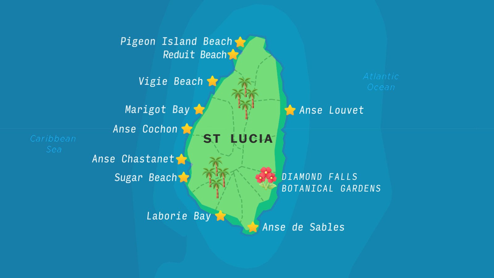
Map of St Lucia
Saint Lucia is an island nation located in the Eastern Caribbean Sea. The area of St Lucia is 617 km². The capital, Castries, is a popular cruise port.
The Saint Lucia coast is home to volcanic beaches; here is the list of famous beaches in St. Lucia:
Anse Cochon Beach
Anse Chastanet Beach
Anse de Sables Beach
Anse Louvet Beach
Laborie Bay
Marigot Bay
Pigeon Island Beach
Reduit Beach
Sugar Beach
Vigie Beach
What country does St Lucia belong to?
St. Lucia became linked to the United Kingdom as a federated state in 1967. It gained independence in 1979 but is still part of the British Commonwealth.